
Walk a Crestview Street Directory
Start with one exact site address. The Property Appraiser identifies the assessed owner and parcel number. WebGIS places that parcel among its neighbors. Official Records then traces recorded transfers and liens, while permit or lien records describe city work at the site. None of these sources names every occupant. A voter record, verified directory entry, obituary, or census line may add a resident, but each carries its own date and legal limits.
The best Crestview street directory search preserves each record's label. A mailing address is where tax notices go. A location, or situs, address is the parcel's physical site. Homestead status can support an owner-occupancy inference, but it does not identify all household members.
- Enter the full address in the Okaloosa Property Appraiser search and copy the parcel ID.
- Open WebGIS, select the parcel, and inspect adjacent lots, aerials, layers, and city limits.
- Use the owner name or legal description in Official Records to find the latest deed.
- Check city permits, inspections, code history, or a paid lien search when they answer the address question.
- For an older household, ask the library which reverse directory or census source covers the year.
Crestview WebGIS Street Tools
Okaloosa WebGIS supports address, owner, parcel, subdivision, and legal-description work after its disclaimer. Map tools include identify, select, point, box, polygon and spatial search, plus layers, aerial imagery, measuring, and print controls. A whole-street view can reveal parcel shapes and adjoining ownership. Mailing-label export, when available, reflects assessed-owner contact, not occupants.
The county GIS office says the Property Appraiser assigns parcel numbers. County Growth Management assigns addresses in unincorporated areas, while incorporated cities assign their own. This split explains why the same postal city name does not always identify the right records office.
| WebGIS input | What it finds | How to verify |
|---|---|---|
| Street address | Site point or parcel | Compare location address |
| Parcel ID | Exact tax parcel | Match parcel card |
| Owner | Assessed ownership | Check deed date |
| Subdivision | Platted group | Read plat and legal description |
| Spatial selection | Adjacent parcels | Open each parcel card |
The source viewer is shown below.
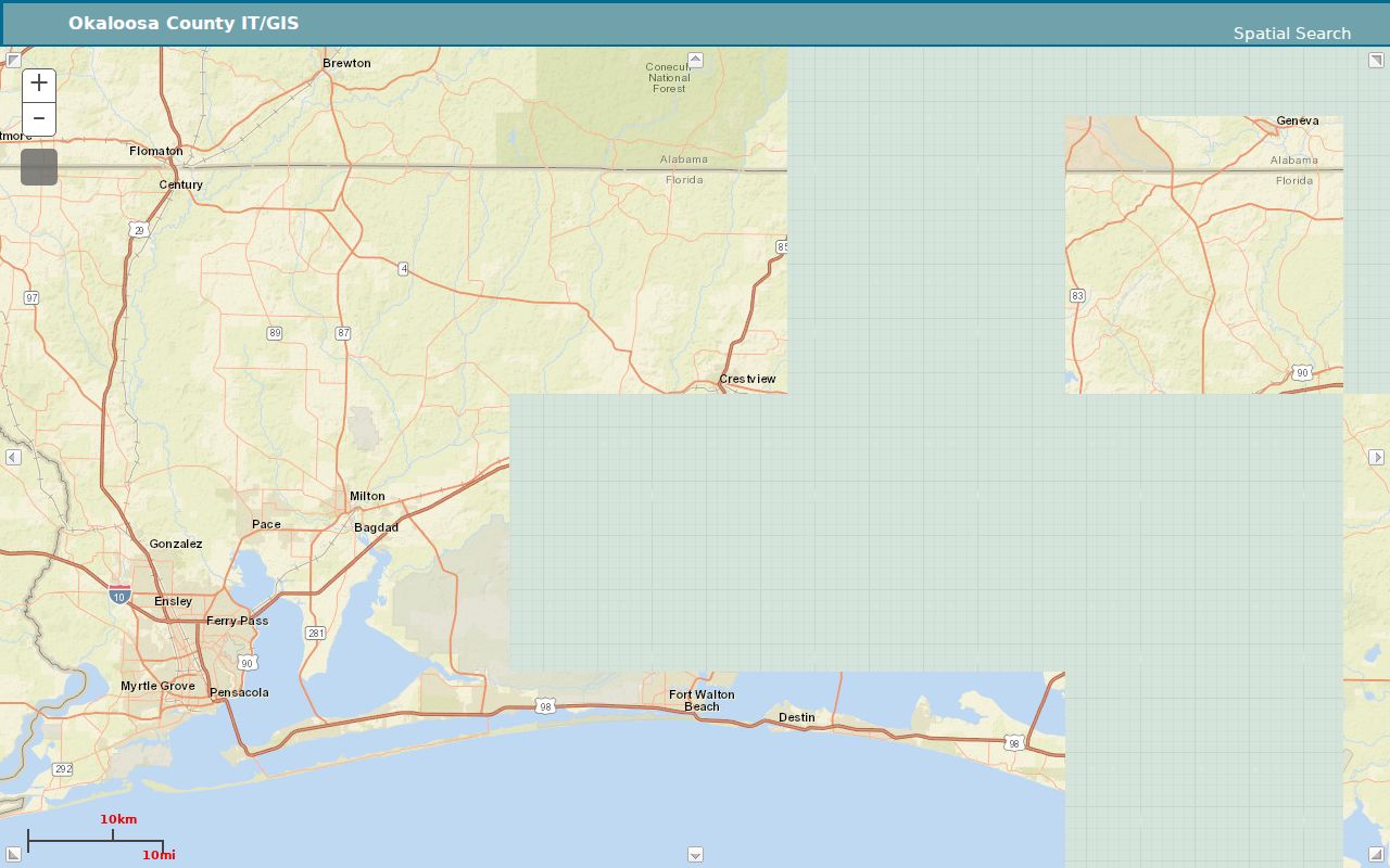
The map view turns one Crestview address into a checked set of surrounding parcels.
Crestview Parcel Cards by Address
The property card records owner name, mailing address, location address, parcel number, legal description, land use, acreage, values, homestead status, sales, and other assessment facts. Search by address first, then retain the parcel ID for every later step. Small spelling changes and road suffixes can alter results.
A parcel card is strong evidence of assessment and ownership on its roll date. It is not a directory of renters or family members. The sample official card below shows why mailing and location fields must stay separate.
Review the official sample parcel card.
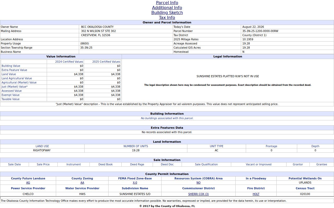
The card supplies the parcel and legal keys needed to move from a street address into deeds and maps.
Crestview Streets and City Lines
A Crestview mailing name does not prove that a parcel lies inside the city. County planning identifies the standard 32536 and 32539 ZIP areas, while city limits, tax districts, E911 zones, subdivisions, and postal routes answer different questions. Official policy acknowledges zig-zag city and county lines that can confuse service responsibility.
Use the Okaloosa street atlas and map downloads with WebGIS. Confirm the tax district on the parcel card. For addressing questions, contact Crestview when the site is incorporated and county Growth Management when it is unincorporated. Annexation can change the custodian without changing the mailing ZIP.
Crestview Street Records Coverage
Address-keyed sources overlap without saying the same thing. The table keeps each roll's proof and access route clear.
| Record Set | Keeper | What It Shows | Access |
|---|---|---|---|
| Property roll | Property Appraiser | Owner, mailing and location addresses, exemptions | Free portal |
| GIS parcel map | Okaloosa GIS | Parcels, address points, layers and aerials | Free viewer |
| Deeds and liens | County Clerk | Transfers, parties, legal descriptions | Free index; copies vary |
| Voter records | Elections Office | Lawfully available registration fields | Self-lookup or request |
| Permits and liens | City of Crestview | Project, inspection and city lien facts | MGO or request |
The parcel ID and legal description are the safest joins. Street spelling can change, but the land description persists. Official Records covers its main online index from January 1, 1983 onward. Older documents use the Alpha Index to find book and page, followed by the main portal or clerk counter.
Crestview Deed Chains by Street
Search the Official Records index with the current assessed owner's name, then confirm the parcel or legal description. In a deed, the grantor gives an interest and the grantee receives it. To trace backward, take the current deed's grantor and search for the earlier instrument in which that person was the grantee.
Results may show party, document type, recording date, instrument number, book and page, and image access. A lien is not a transfer. A satisfaction may release a lien or mortgage. Read the document type and image before drawing a conclusion. For pre-1983 work, the Alpha Index and courthouse counter are part of the normal chain.
Crestview Permits and City Liens
Crestview uses MyGovernmentOnline for permit applications, payments, plan files, status tracking, inspection requests, reports, and notices. A free customer account supports submissions. An address may connect a permit to an applicant or project contact, but it does not prove that person occupied the site.
The city's lien-search request covers code violations, permit issues, and city liens. Research reports a $65 charge and a stated one-to-three-business-day turnaround. When only an existing code or permit record is needed, identify it precisely and use the responsible department or the City Clerk's Chapter 119 channels.
Crestview Reverse Directory Gaps
A criss-cross directory is arranged by street and house number rather than by surname. It can connect a dated address to a listed householder, but exact Crestview titles and years have not been verified online. Ask the Crestview Public Library reference desk, the Okaloosa cooperative catalog, or Baker Block Museum for a year-specific volume before citing an entry.
- Parcel
- A mapped unit of land used for assessment.
- Situs address
- The physical location of the parcel, unlike the tax mailing address.
- Plat
- A recorded map dividing land into lots, blocks, roads, or easements.
- Criss-cross directory
- A printed directory ordered by address, often useful for past households.
The full historical shelf belongs in the Crestview city directory. Here, an old volume serves only as one dated street clue.
Crestview Address Point Details
County GIS address-point data adds detail that parcel polygons cannot supply. A point can carry a full address, site detail, parcel identifier, zone ZIP, municipality, and public-safety response fields. This helps at multiunit sites where several addressed places may sit on one tax parcel. It also helps separate duplicate street numbers that would be unclear without the road name, directional, ZIP, or response zone.
The county layer is an official GIS source, but map data is not a survey and should not replace a deed or plat. Compare each point with the parcel card. If an address looks wrong, direct the question to Crestview within city limits or Okaloosa Growth Management outside them.
The county address-point GIS service exposes the mapped layer.
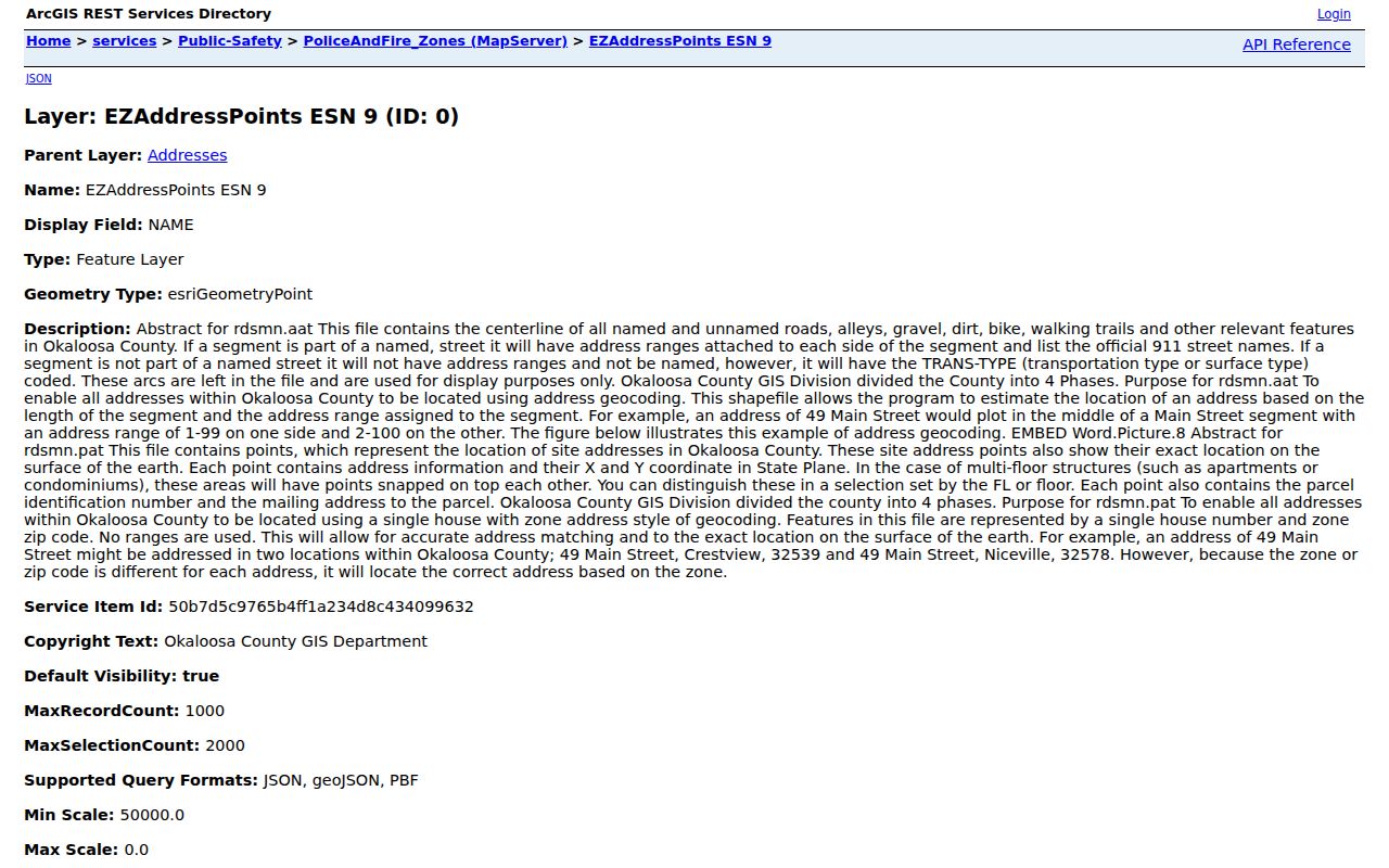
The points help resolve sites that a road-range estimate or parcel outline alone may misread.
Crestview Voter Street Requests
The county voter-status tool is designed for individual checks, not public browsing of every person on a street. Florida makes many adult registration fields public, but credentials, registration source, signature copies, protected voters, and preregistered minors receive safeguards. Nonvoters are absent, and registration may lag a move.
For a lawful civic or family-history need, ask the Supervisor of Elections whether an existing street or precinct subset is available and what fields, format, update date, price, and suppression rules apply. Never treat the result as a full household roster. A voter entry establishes registration data on its date, not ownership or physical presence today.
Crestview Street Directory Limits
A public street directory cannot produce a complete, current roster of everyone at an address. Property files name assessed owners. Deeds name document parties. Permits name applicants or contacts. Voter records omit nonvoters and suppress protected data. Utility accounts and motor-vehicle address data are not open household lists. Multiunit sites may also share one parcel while using many address points.
Florida law shields credentials, signatures, victim information, protected voter addresses, juvenile or sealed court material, and other exempt facts. Do not rebuild a suppressed address from another source. A record that is absent online may still be available by phone, mail, email, counter service, or a focused public-record request, subject to exemptions.
An address can also change meaning over time. A modern road label may not match an older plat, deed, directory, or census description. Start with the current parcel card, then retain its legal description, subdivision, lot, block, and parcel identifier. Those stable land keys help bridge spelling shifts and road-name changes. No verified Crestview-wide renumbering table was found online, so ask City Development, county GIS, the library, or the clerk for an existing map or conversion record instead of guessing.
Jurisdiction deserves a separate check. A 32536 or 32539 mailing address can fall inside Crestview, in an unincorporated area, or in a planning geography that crosses the corporate line. WebGIS city-limit layers and the parcel tax district help select the right custodian. Crestview handles addresses within the incorporated city, while Okaloosa Growth Management assigns addresses in unincorporated territory. Annexation may change the responsible office even when the postal city and ZIP remain the same.
Finally, treat dates as part of every street-directory fact. The assessment roll reflects a roll date. A deed reflects a recorded transfer. A permit reflects a project period. Voter data reflects registration at a particular update. A printed reverse directory reflects its publication year. Put those dates beside the names, then compare the parcel number, legal description, and record role. This method separates a current assessed owner from a former owner, applicant, registered voter, or past listed householder without turning any one source into a claim it cannot support.
Lawful use. Crestview address records support personal, civic, property, and family-history research. Never use them to stalk, harass, threaten, or harm a person.
Date each Crestview street result and save its parcel, instrument, or request identifier. These key details make later source checks and corrections far easier for every address.